
Pilot’s idea takes off
April 5, 2022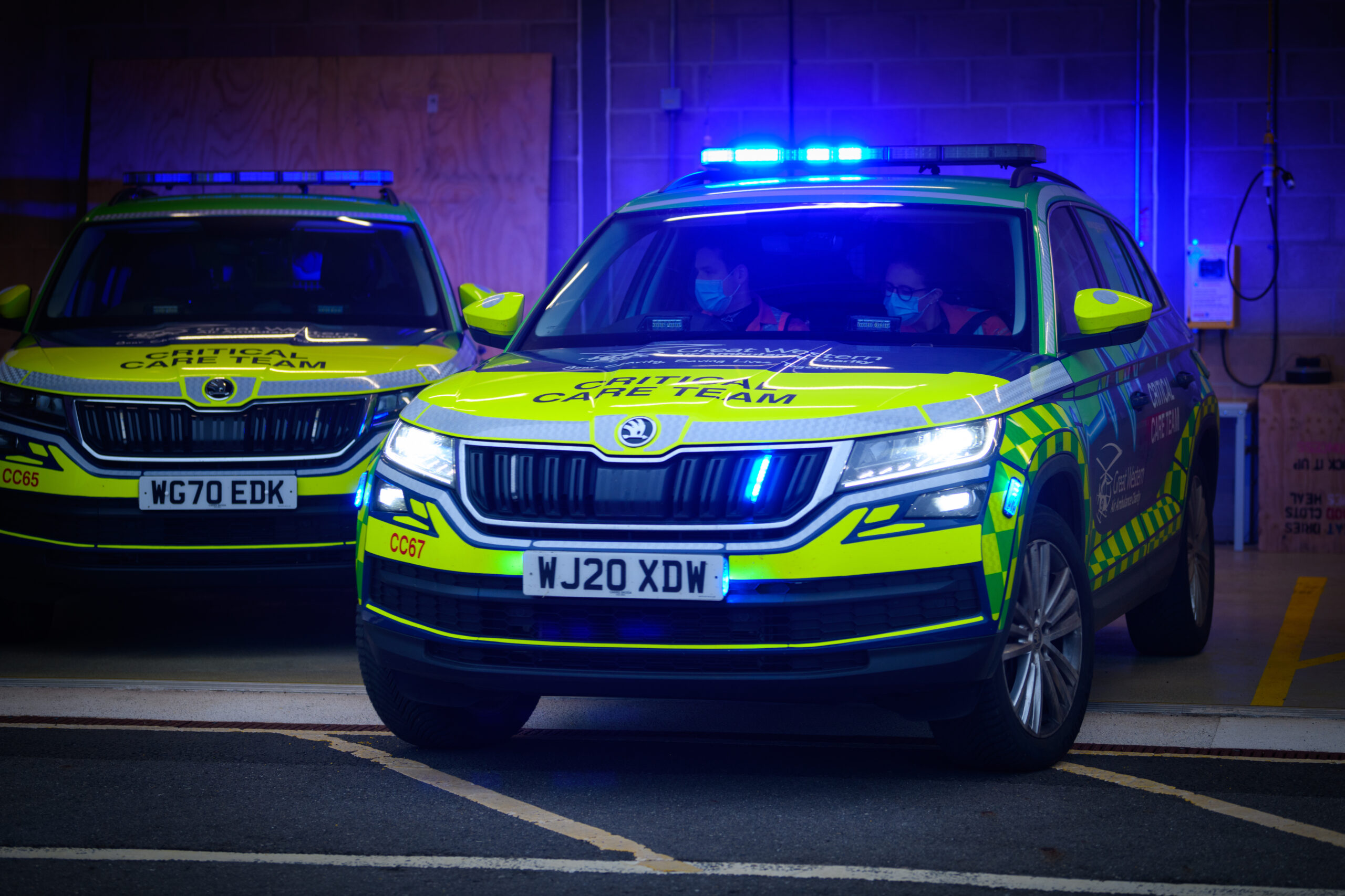
Our Critical Care Cars
April 16, 2022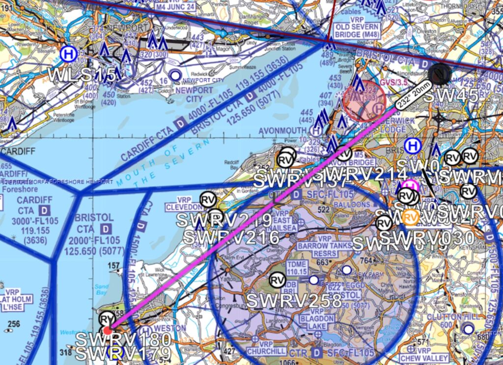
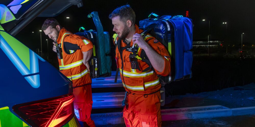
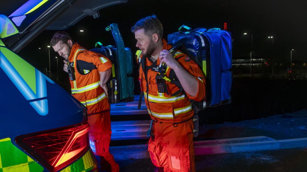
Our highly skilled crew makes decisions every day, decisions that can mean the difference between life and death. The decision-making process starts before they even get to the patient. It starts at the Great Western Air Ambulance Charity (GWAAC) base.
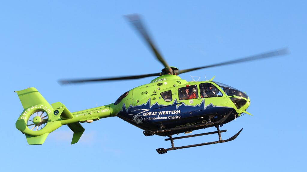
When a call comes in, the crew decides whether to fly or drive
“The method of transport should be whichever gets us to the patient the quickest. We are privileged with a great road network, with our base situated on an interchange – so the ground distance we can cover by car is surprisingly far. We are probably talking of equal journey times by car and air when responding from base to areas such as Gloucester or Weston-super-Mare. However, both these locations are immediately off the motorway whereas areas of a similar distance, such as Cirencester or Coleford, are rapidly reached by air because of the road network.”
- Matt Robinson, Specialist Paramedic in Critical Care
The crew uses an iPad app called Airbox ACANS for flight planning and en route navigation. ACANS provides instant access to specialist aviation charts, ordnance survey mapping, and satellite imagery.
The iPads act as a moving map and are used by the pilot and paramedic to navigate in-flight. They also provide the crew with an Electronic Flight Bag (EFB) capability. The EFB is uploaded with electronic copies of all of the documentation required to support flight operations; documentation that would once have been carried in a physical flight bag containing up to 10Kg of paper.
The weight saved by the use of an EFB enables the helicopter to carry an additional payload equivalent to three minutes of aviation fuel.
Location is key, but there are other factors to consider
-
Time of day
In the winter the aircraft is available 07:00 – 17:00. It can only land after dark at surveyed landing sites such as our base or hospital helipads. In the Summer months, due to longer daylight hours, the aircraft is available until 19:00. Our three critical care cars are operational from 07:00 all the way through to 01:00 the next morning.
-
Traffic
Road traffic conditions will influence the crew’s decision on whether to fly or drive. Helicopters don’t get stuck in traffic jams or have to navigate the hard shoulder of a motorway!
-
Weather conditions
Our helicopter is operated under a special Helicopter Emergency Medical Service (HEMS) approval. HEMS weather limits are:Day: Met visibility 1500m; cloud ceiling 500ft.
Night: Met visibility 3000m; cloud base 1200ft. -
Landing sites
Whilst the crew may arrive more quickly overhead at the scene of an incident when travelling by helicopter (compared to travelling by car), the additional time taken to land and then travel on foot to the patient is a consideration. Good examples of where this may be a factor are the built-up areas of South Bristol, such as Totterdown and Bedminster. Landings on motorways can also be delayed by the requirement for the Police to stop traffic in both directions beforehand, a process which can take considerable time.
-
Actions taken by road ambulance crews.
A land ambulance crew may request our assistance after the assessment of a patient. In this case, the GWAAC Critical Care Team may recommend that they make headway towards a hospital and agree to rendezvous en route. The road network will be a consideration when deciding whether to travel to the rendezvous point by car or helicopter.
Pilot Alan Petch’s Landing Sites Project
In December 2021, former GWAAC Pilot, Alan Petch won Pilot of the Year Award for his innovative use of technology which involved establishing a database of potential landing sites throughout GWAAC’s operating area.
The database assists with flight planning, minimising response times, facilitating integration with other emergency service assets, and enhancing flight safety. The “Southwest Rendezvous Directory” lists over 250 sites in Bristol, Bath, Gloucester, Cheltenham, the Stroud Valley, Weston-super-Mare, and a number of other densely populated areas. It’s a valuable resource that can be used in the crew’s decision-making process on whether to fly or drive.
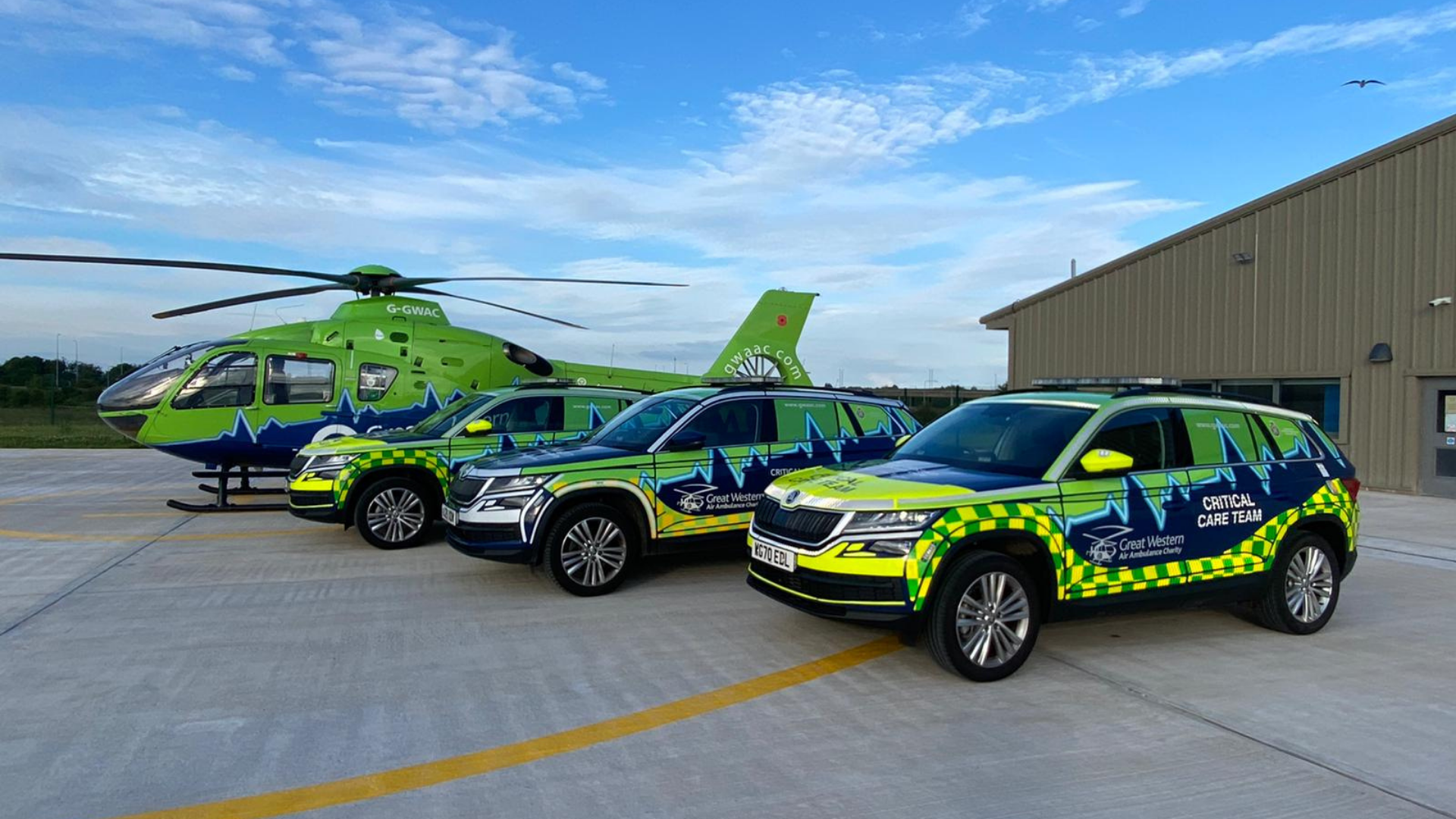
A full fleet of critical care cars
In June 2021, we completed our fleet of response vehicles. We now have three critical care cars which are vital in enabling our crew to reach more critically ill or injured patients across the region. Having a third car has ensured our service is more reliable and resilient for those who need us every single day.
We now have the resource to bring our lifesaving emergency care to up to 50 additional patients a year. Our cars carry the same lifesaving medical equipment as the helicopter including ventilators and advanced drugs not found on a land ambulance. This ensures that those in need can still receive urgent and specialist care from our crew.
Check out our Frequently Asked Questions page to learn even more about the service we provide.
“The method of transport should be whichever gets us to the patient the quickest. We are privileged with a great road network, with our base situated on an interchange – so the ground distance we can cover by car is surprisingly far. We are probably talking of equal journey times by car and air when responding from base to areas such as Gloucester or Weston-super-Mare. However, both these locations are immediately off the motorway whereas areas of a similar distance, such as Cirencester or Coleford, are rapidly reached by air because of the road network.”
-

- SWRV Directory Bath
-

- SWRV Directory Yate
-

- SWRV Directory Weston-super-Mare
-

- SWRV Directory Stroud
-

- SWRV Directory Portishead
-

- SWRV Directory Gloucester
-

- SWRV Directory Bristol
-

- ACANS Flight Planning Example Weston-super-Mare
-

- ACANS flight planning example Swindon
-

- -ACANS flight planning example Moreton-in-Marsh
-

- ACANS flight planning example Gloucester
-

- ACANS Flight Planning Example Forest of Dean
-

- ACANS flight planning example Bath